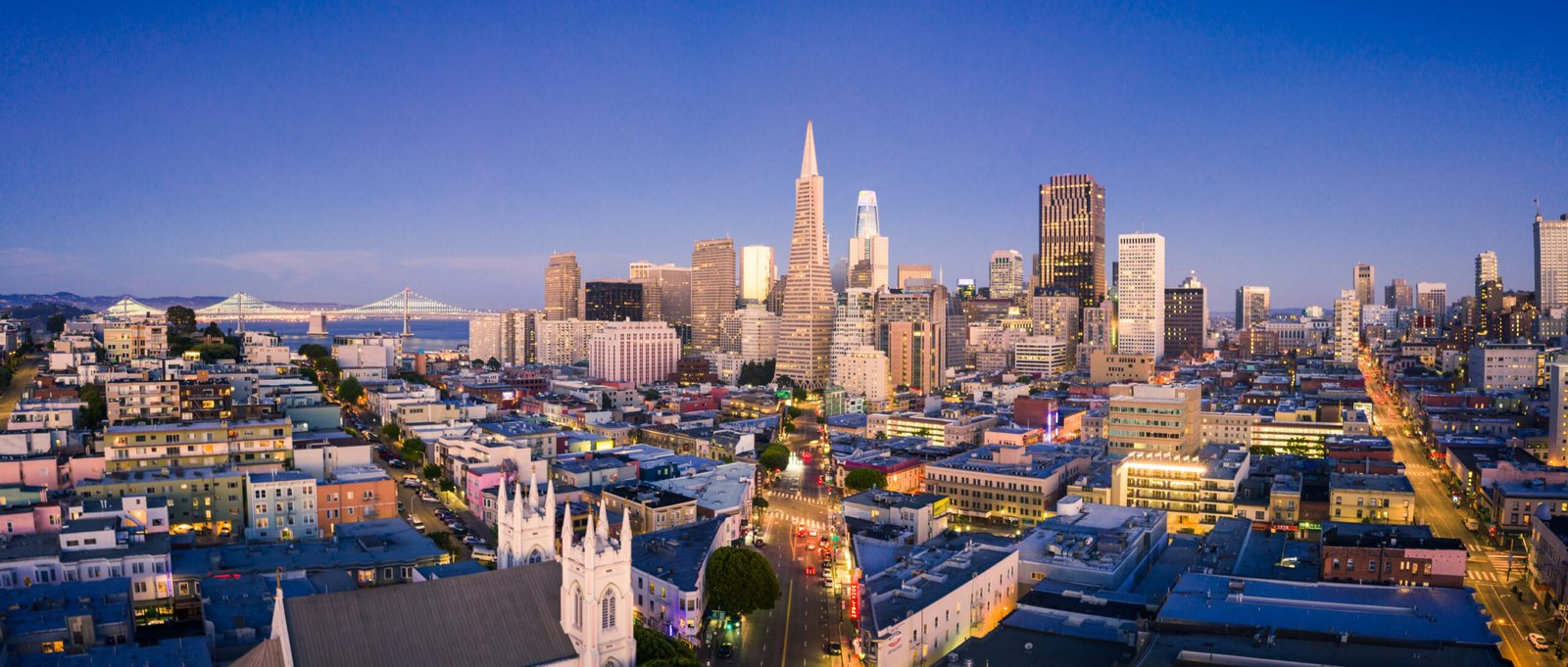
San Francisco captivates millions of visitors each year with its iconic landmarks, diverse neighborhoods, and unparalleled…
Master the Hills: Your Complete Guide to Getting Around San Francisco
San Francisco isn’t just a city—it’s a vertical adventure waiting to challenge every step, pedal, and ride you take. With its legendary 43 hills, unpredictable fog that rolls in like a living creature, and microclimates that can shift from sunny to chilly within a single block, navigating the City by the Bay requires more than just a good sense of direction. It demands strategy, stamina, and a healthy sense of humor.
Whether you’re a first-time tourist clutching a crumpled map, a business traveler trying to make it to that crucial meeting on time, a local resident still discovering new routes after years of living here, a fitness enthusiast ready to conquer those infamous inclines, or a budget traveler counting every dollar, this guide will transform you from a bewildered wanderer into a confident San Francisco navigator.
The Public Transportation Mastery
Muni: Your Reliable City Companion
The San Francisco Municipal Transportation Agency (Muni) operates the most comprehensive public transit system in the city, and mastering it feels like earning a badge of honor. With buses, light rail, cable cars, and streetcars, Muni connects every neighborhood with surprising efficiency—once you understand its rhythm.
Pro tip for business travelers: Download the Muni Mobile app and purchase your passes digitally. The app provides real-time arrival information that’s surprisingly accurate, helping you avoid those awkward moments of sprinting uphill in business attire.
The Muni Passport offers unlimited rides for 1, 3, or 7 days, making it perfect for tourists who want to explore without worrying about individual fares. For locals and extended visitors, the monthly pass provides excellent value and the psychological freedom of hopping on and off without mental fare calculations.
BART: Your Gateway Beyond the City
Bay Area Rapid Transit (BART) connects San Francisco to the broader Bay Area with impressive speed and efficiency. The system runs deep underground through the city, emerging to cross the bay via tunnels and bridges that offer spectacular views.
For fitness enthusiasts: BART stations often require significant walking and stair climbing. The Montgomery Street station, for instance, sits several stories underground—consider it part of your daily workout routine.
Cable Cars: The Moving Landmarks
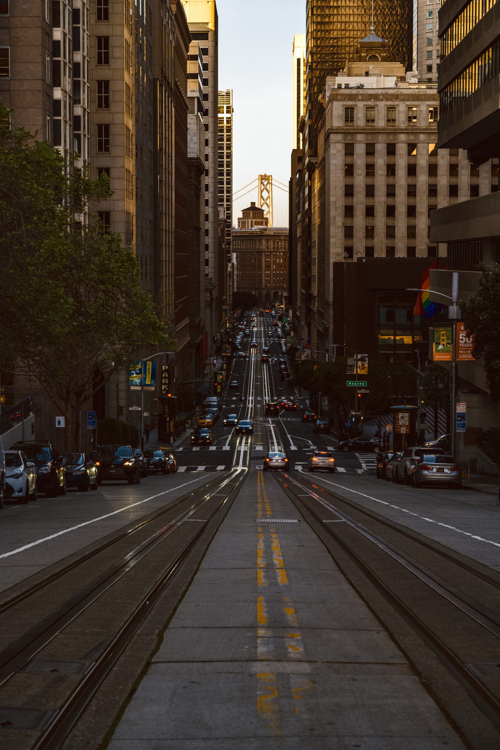
San Francisco’s cable cars aren’t just transportation; they’re moving pieces of history that happen to get you up impossibly steep hills. The three lines—Powell-Hyde, Powell-Mason, and California Street—each offer unique experiences and stunning views.
Budget traveler alert: At $8 per ride, cable cars are expensive for regular transportation, but they’re worth experiencing at least once. Ride during off-peak hours for shorter lines and better photo opportunities.
Book Cable Car Tickets Online to skip the tourist lines and guarantee your spot on these iconic vehicles.
Walking San Francisco Like a Local
Conquering the Hills with Strategy
Walking in San Francisco requires tactical planning. The city’s grid system can deceive newcomers—what looks like a straight shot on the map might involve a 30-degree incline that leaves you questioning your life choices.
The Stairway Strategy: San Francisco boasts over 600 public stairways, many offering shortcuts and stunning views. The Filbert Street Steps and Greenwich Steps on Telegraph Hill provide alternatives to steep street walking while rewarding you with gardens and bay views.
Microclimate Awareness: Pack layers, always. You might start your walk in sunny Mission Dolores and end up in foggy Marina District feeling like you’ve traveled through different seasons. A light jacket or sweater becomes your best walking companion.
Essential Walking Routes for Every Interest
For Scenic Beauty: The Lands End Coastal Trail offers dramatic ocean views and leads to the iconic Sutro Baths ruins. This relatively flat 1.5-mile trail proves that not all San Francisco walks require mountaineering skills.
For Urban Exploration: Walk from Union Square through Chinatown to North Beach, experiencing three distinct neighborhoods in under two miles. The route includes manageable hills and showcases the city’s cultural diversity.
For Fitness Challenges: Tackle the Lombard Street to Coit Tower route, which includes the famous “crookedest street in the world” and rewards your effort with panoramic city views from Telegraph Hill.
Biking: Pedal Power Meets Hill Power
Bike-Friendly Routes That Won’t Destroy Your Legs
Contrary to popular belief, San Francisco offers numerous bike-friendly routes that avoid the steepest climbs. The key lies in understanding the city’s topography and choosing your battles wisely.
The Embarcadero: This flat, waterfront route stretches from AT&T Park to Fisherman’s Wharf, offering bay views without elevation challenges. Perfect for leisurely rides and family cycling.
Golden Gate Park: With over 1,000 acres of relatively flat terrain, the park provides miles of cycling paths away from traffic. The Panhandle connects the park to downtown areas via a protected bike lane.
The Wiggle: This ingenious route uses a series of connected streets to navigate from the Haight to downtown with minimal hill climbing. Local cyclists have perfected this path over decades.
Bike Rental and Safety Considerations
Rental Options: Companies like Bay City Bike and Blazing Saddles offer everything from standard bikes to electric models that make hill climbing manageable for any fitness level.
Safety First: San Francisco drivers are generally bike-aware, but the city’s hills create unique visibility challenges. Always use lights, wear bright colors, and assume drivers might not see you around blind corners.
Find Bike Rental Locations and compare prices across the city’s top rental companies.
Ride-Sharing and Taxi Navigation
Smart Strategies for App-Based Transportation
Uber and Lyft dominate San Francisco’s ride-sharing landscape, but using them effectively requires local knowledge. Surge pricing often kicks in during peak hours, major events, and foggy weather when other transportation options become less appealing.
Business Traveler Tip: Schedule rides in advance for airport trips. San Francisco International Airport (SFO) sits 13 miles south of downtown, and traffic patterns can dramatically affect travel time.
Budget-Conscious Approach: Use UberPool or Lyft Shared for significant savings, but allow extra time as these services make multiple stops. The savings often justify the additional travel time, especially for longer distances.
Traditional Taxi Services
While less common than ride-sharing, traditional taxis still serve important roles, especially in areas with poor cell service or during high-demand periods when app-based services become expensive.
Taxi advantages: No surge pricing, ability to hail on the street, and drivers with extensive local knowledge who can navigate efficiently through traffic and construction.
Scenic Routes: Transportation with a View
Must-Experience Scenic Transportation
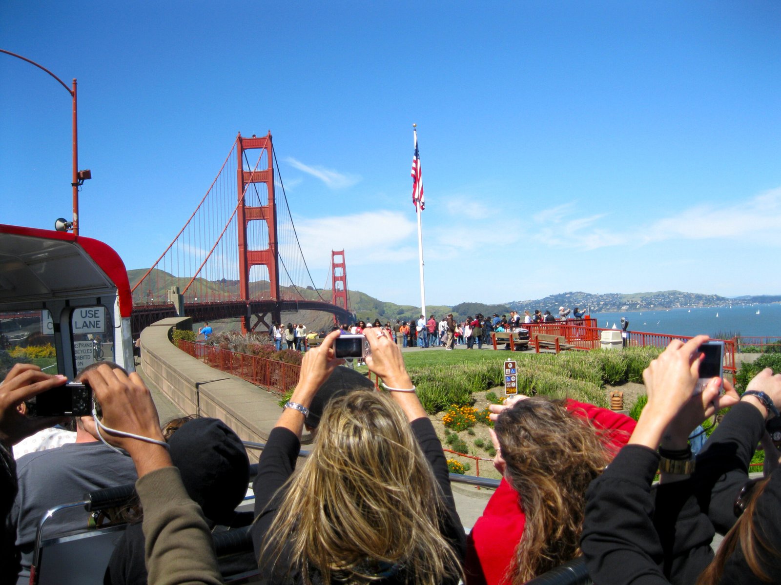
Golden Gate Bridge Approaches: Whether walking, biking, or driving, approaching the Golden Gate Bridge offers multiple spectacular vantage points. The Crissy Field route provides stunning bridge views with minimal elevation gain.
Twin Peaks Boulevard: This winding road leads to the city’s geographic center and highest point accessible by car. The 360-degree views justify the challenging drive or strenuous hike.
California Street Cable Car: This line offers the most panoramic city views of all cable car routes, climbing from the Financial District to the top of Nob Hill with sweeping vistas of the bay and city skyline.
Ferry Routes for Water Views
Golden Gate Ferry and Blue & Gold Fleet provide unique perspectives of the city skyline while connecting San Francisco to Marin County and other bay destinations. These ferries offer comfortable seating, onboard refreshments, and unbeatable photo opportunities.
Alcatraz Island Ferry: Beyond the famous prison tour, the ferry ride itself provides exceptional views of the city, bay, and surrounding islands.
Book Ferry Tickets and secure your spot for these popular scenic routes.
Navigating San Francisco’s Unique Challenges
Mastering the Steep Hills
San Francisco’s 43 named hills create the city’s character but challenge every form of transportation. Russian Hill, Nob Hill, and Telegraph Hill require specific strategies depending on your chosen transportation method.
Driving Tips: Use your parking brake religiously, turn wheels into the curb when parking on inclines, and consider your vehicle’s capabilities before attempting the steepest streets like Filbert Street (31.5% grade).
Walking Strategies: Take frequent breaks, stay hydrated, and don’t be embarrassed to zigzag up steep inclines to reduce the grade. Locals do it too.
Fog Impact on Transportation
San Francisco’s fog, affectionately named Karl, dramatically affects visibility and temperature throughout the city. The fog typically rolls in from the ocean during late afternoon and evening, creating microclimates that can catch visitors off guard.
Transportation Adjustments: Allow extra travel time during foggy conditions, use headlights while driving even during daytime, and dress in layers as you might encounter multiple climate zones during a single journey.
Neighborhood Variations: The Mission District often remains sunny and warm while the Sunset District disappears into fog. Plan your activities and transportation accordingly.
Parking Difficulties and Solutions
Parking in San Francisco ranks among the most challenging aspects of city navigation. Street parking requires patience, quarters for meters, and careful attention to complex signage that can change multiple times within a single block.
Alternative Solutions:
- Use SpotHero or ParkWhiz apps to reserve parking spots in advance
- Consider park-and-ride options using BART or Muni from less congested areas
- Many hotels offer valet parking that, while expensive, eliminates the stress of finding street parking
Understanding Microclimates
San Francisco’s microclimates can shift dramatically within a few blocks. The Mission District might be sunny and 75°F while Ocean Beach sits shrouded in fog at 55°F—simultaneously.
Practical Applications: Check weather conditions for your specific destination, not just “San Francisco” in general. Apps like Weather Underground provide neighborhood-specific forecasts that prove invaluable for transportation planning.
Budget-Friendly Transportation Strategies
Money-Saving Tips for Every Traveler Type
For Extended Stays: Purchase a monthly Muni pass ($81) if you’ll be in the city for more than two weeks. The pass pays for itself quickly and provides unlimited access to the entire Muni system.
For Tourist Exploration: The CityPASS includes Muni transportation along with admission to major attractions, providing significant savings for visitors planning to see multiple sights.
For Fitness-Focused Travel: Combine transportation with exercise by walking or biking between nearby destinations. San Francisco’s compact size makes this surprisingly practical for many trips.
Free Transportation Options
Walking: Obviously free and often faster than driving in congested areas. Many of San Francisco’s most interesting neighborhoods are highly walkable once you’re within them.
Hotel Shuttles: Many downtown hotels offer complimentary shuttles to popular destinations like Union Square, Fisherman’s Wharf, and shopping districts.
Company Shuttles: Tech companies operate extensive shuttle networks that sometimes allow non-employees to ride for free or minimal cost.
Essential Apps and Resources
Must-Have Transportation Apps
Citymapper: Provides comprehensive route planning across all transportation modes, including real-time updates and alternative options when delays occur.
Muni Mobile: Official app for purchasing passes and tracking real-time arrival information for all Muni vehicles.
Transit: Clean, simple interface showing nearby departure times for all public transportation options.
BART Official App: Essential for Bay Area travel with real-time departure information and service alerts.
Emergency Transportation Resources
Taxi Companies:
- Yellow Cab: (415) 333-3333
- Luxor Cab: (415) 282-4141
Emergency Services: Always call 911 for emergencies, but for non-emergency transportation assistance, contact:
- SFMTA Customer Service: (415) 701-4500
- BART Customer Service: (510) 464-6000
Download Essential Apps and save these emergency contacts to your phone before exploring the city.
Seasonal Transportation Considerations
Summer Navigation (June-August)
Summer brings peak tourist season, creating crowded public transportation and increased traffic congestion. Cable cars experience the longest wait times, and popular destinations like Fisherman’s Wharf become challenging to reach quickly.
Strategy: Start your day early to avoid crowds, use less popular transportation routes, and consider exploring neighborhoods like the Mission or Castro that offer authentic San Francisco experiences with fewer tourists.
Winter Wisdom (December-February)
San Francisco’s mild winter still brings increased rainfall and occasional strong winds that affect transportation choices. Biking becomes less appealing, and walking requires waterproof gear.
Adaptations: Carry a compact umbrella, wear shoes with good traction for wet hills, and allow extra time for all forms of transportation as locals tend to drive more cautiously in rain.
Neighborhood-Specific Transportation Tips
Financial District and Downtown
Peak Hours: Avoid driving downtown between 7-9 AM and 5-7 PM when business commuters create significant congestion. Public transportation becomes your fastest option during these periods.
Parking Reality: Street parking costs $3-4 per hour with strict time limits. Parking garages charge $20-40 per day but provide guaranteed spots.
Mission District
Transportation Advantages: Excellent Muni bus connections, relatively flat terrain for walking and biking, and abundant ride-sharing availability.
Local Tip: The 24th Street BART station provides easy access to other parts of the Bay Area while keeping you in the heart of one of San Francisco’s most vibrant neighborhoods.
Richmond and Sunset Districts
These residential neighborhoods offer more parking and less congestion but require longer commutes to downtown attractions.
Best Practices: Use the N-Judah or L-Taraval Muni lines for efficient downtown connections, or drive to park-and-ride locations to avoid downtown parking challenges.
Transportation Etiquette and Local Customs
Public Transportation Courtesy
Muni Etiquette: Move to the back of buses and trains, offer seats to elderly and disabled passengers, and keep backpacks in front of you during crowded periods.
Cable Car Protocol: Let passengers exit before boarding, hold on tightly (the hills are real), and tip the conductor if you enjoyed the ride.
Sharing the Road
Bike Lane Respect: Don’t walk, drive, or park in bike lanes. San Francisco cyclists are passionate about their designated spaces, and violations create dangerous situations.
Pedestrian Awareness: San Francisco drivers generally respect pedestrians, but always make eye contact before crossing and use designated crosswalks whenever possible.
Ready to conquer San Francisco’s transportation challenges? Start with one method that matches your comfort level and gradually expand your skills. The city rewards those who embrace its unique character, and soon you’ll find yourself navigating these hills with the confidence of a true San Franciscan.
Plan Your San Francisco Adventure with our interactive transportation planner, or Download Our Mobile Guide for offline access to all these tips and more.
Remember: In San Francisco, the journey truly is as important as the destination. Embrace the hills, laugh at the fog, and enjoy every moment of your vertical adventure through one of the world’s most beautiful cities.
More to Explore