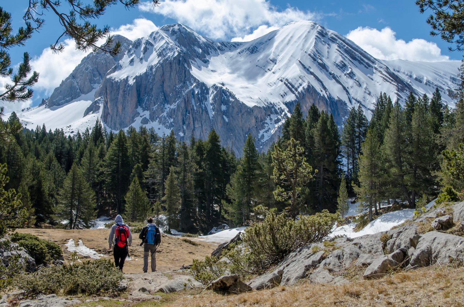
Standing at 11,053 feet above sea level, Mammoth Mountain beckoned to me like…
Mammoth Mountain Weather Wisdom: Understanding Sierra Nevada Climate Patterns
With decades of meteorological expertise and deep regional knowledge, we present the definitive guide to understanding the complex weather patterns that shape Mammoth Mountain and the greater Sierra Nevada region. Through comprehensive analysis and local insight, we illuminate the intricate climate systems that define this remarkable mountain environment.
WINTER DOMINANCE: December Through March
The Snow Machine Awakens
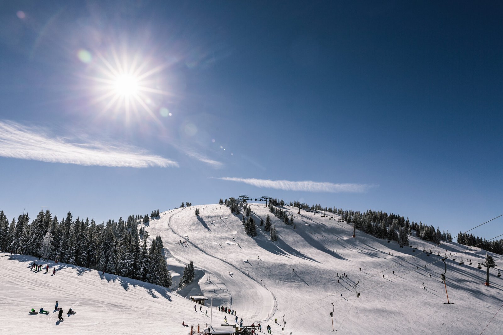
Winter transforms Mammoth Mountain into a meteorological powerhouse. Pacific storm systems collide with the Sierra Nevada’s towering peaks, creating the legendary snowfall that defines the region. Average snowfall exceeds 400 inches annually, with peak accumulation occurring between January and February.
Temperature Patterns:
- Daytime highs: 25-35°F at base elevation
- Nighttime lows: 5-15°F
- Summit conditions: Often 20-30°F colder than base
The orographic effect plays a crucial role during winter months. As moisture-laden air masses from the Pacific Ocean encounter the Sierra Nevada’s steep eastern face, they’re forced upward, cooling rapidly and releasing massive amounts of precipitation as snow.
Storm Cycles and Atmospheric Rivers
Winter weather patterns follow distinct cycles. Atmospheric rivers – narrow corridors of concentrated water vapor – deliver the most significant snowfall events. These “rivers in the sky” can dump 3-6 feet of snow in 48-72 hours, creating both exceptional skiing conditions and potential hazards.
SPRING TRANSITION: April Through May
The Great Melt Begins
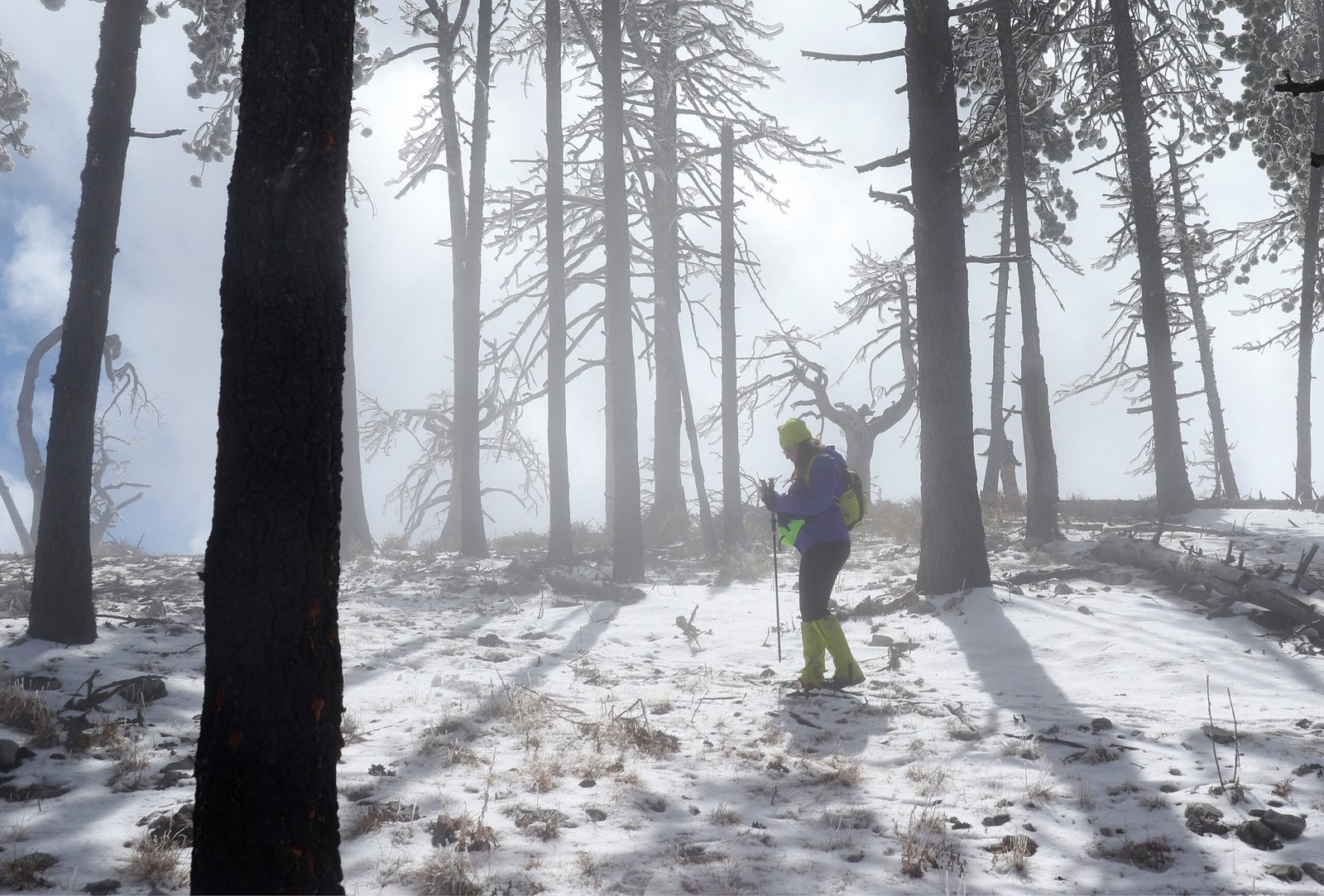
Spring represents the most volatile weather period at Mammoth Mountain. Temperature swings of 40-50°F between day and night create challenging conditions for outdoor enthusiasts. Corn snow develops on south-facing slopes while north-facing aspects retain powder conditions.
Key Spring Characteristics:
- Rapid temperature fluctuations
- Increased avalanche danger due to warming trends
- Variable snow conditions throughout single days
- Extended daylight hours affecting snow stability
The freeze-thaw cycle dominates spring weather patterns. Daytime solar heating creates surface melt, while nighttime refreezing forms crusts that significantly impact skiing and hiking conditions.
SUMMER SERENITY: June Through August
High-Altitude Paradise
Summer unveils Mammoth Mountain’s gentler personality. Clear skies dominate, with over 300 sunny days annually. However, afternoon thunderstorms provide dramatic displays and essential moisture for alpine ecosystems.
Summer Weather Characteristics:
- Daytime temperatures: 70-80°F at base, 50-60°F at summit
- Minimal precipitation: Less than 2 inches monthly
- Low humidity: Often below 30%
- Intense UV exposure due to high elevation and thin atmosphere
Thunderstorm Development
Afternoon thunderstorms follow predictable patterns. Convective heating creates towering cumulus clouds by early afternoon, often producing lightning, brief heavy rain, and occasional hail above 9,000 feet elevation.
Safety Protocol: Outdoor activities should conclude by 1:00 PM during peak thunderstorm season.
AUTUMN AWAKENING: September Through November
The Return of Winter’s Promise
Autumn brings dramatic weather transitions. Early season snowfall can occur as early as mid-September at summit elevations, while base areas enjoy extended warm weather through October.
Temperature Inversions become common during autumn months. Cold air settles in valleys while warmer air remains at higher elevations, creating unique microclimates throughout the mountain.
EXTREME WEATHER PHENOMENA
The Legendary Storm Events
Mammoth Mountain has witnessed extraordinary weather events that reshape our understanding of Sierra Nevada climate patterns:
Record Snowfall Events:
- January 1969: 26 feet in 10 days
- March 1991: 15 feet in 72 hours
- February 2019: 12 feet in 5 days
Wind Phenomena
Chinook winds occasionally create dramatic warming events, raising temperatures by 40-50°F within hours. These dry, warm winds can rapidly change snow conditions and create challenging avalanche scenarios.
The Mammoth Creek Wind Tunnel Effect funnels air through the valley, creating localized wind speeds exceeding 100 mph during severe weather events.
CLIMATE CHANGE IMPACTS
Shifting Patterns and New Realities
Recent decades reveal significant changes in traditional weather patterns:
Temperature Trends:
- Average winter temperatures have increased 3-4°F since 1970
- Earlier snowmelt by 2-3 weeks compared to historical averages
- Reduced snowpack duration at lower elevations
Precipitation Changes:
- More rain-on-snow events during winter months
- Increased storm intensity but potentially fewer total storm days
- Extended drought periods alternating with extreme wet years
GEOGRAPHIC CLIMATE ZONES
Understanding Elevation-Based Weather Systems
Mammoth Mountain’s diverse elevation profile creates distinct climate zones:
Base Area (8,900 feet):
- Moderate temperatures year-round
- Mixed precipitation during transition seasons
- Longest growing season for vegetation
Mid-Mountain (9,500-11,000 feet):
- Primary snow accumulation zone
- Consistent winter conditions
- Optimal skiing climate
Summit Zone (11,053+ feet):
- Alpine tundra conditions
- Extreme temperature variations
- Year-round potential for snow
WEATHER FORECASTING MASTERY
Professional Forecasting Techniques
Understanding Mammoth Mountain weather requires sophisticated analysis of multiple atmospheric variables:
Key Indicators to Monitor:
- 500mb Height Patterns – Upper-level atmospheric steering
- Surface Pressure Gradients – Storm intensity prediction
- Precipitable Water Values – Snowfall potential assessment
- Freezing Level Heights – Rain-snow line determination
Local Weather Station Network
Our comprehensive monitoring system includes:
- NOAA Automated Weather Stations at multiple elevations
- SNOTEL Sites for snowpack monitoring
- Avalanche Weather Stations for backcountry safety
Access Real-Time Weather Data →
Microclimate Recognition
Experienced weather observers recognize subtle environmental cues:
- Cloud formation patterns indicating incoming storms
- Wind direction changes signaling weather transitions
- Temperature gradient variations affecting snow conditions
SAFETY AND PREPAREDNESS
Essential Weather Awareness
Mountain weather demands respect and preparation:
Critical Safety Protocols:
- Layer clothing systems for rapid temperature changes
- Monitor weather updates every 2-4 hours during outdoor activities
- Understand avalanche bulletins and terrain assessment
- Carry emergency communication devices in backcountry areas
Emergency Weather Resources:
- National Weather Service Reno Office – Primary forecasting authority
- Mammoth Mountain Ski Patrol – Local conditions expertise
- Eastern Sierra Avalanche Center – Backcountry safety information
Download Emergency Weather App →
HISTORICAL WEATHER WISDOM
Learning from the Past
Historical weather records reveal patterns that guide modern understanding:
Decade-by-Decade Analysis:
- 1970s: Consistent heavy snowfall years
- 1980s: Introduction of El Niño/La Niña pattern recognition
- 1990s: Record-breaking storm events and drought cycles
- 2000s: Climate change signal emergence
- 2010s: Extreme variability and new record events
Traditional Weather Lore
Local weather wisdom passed through generations:
- “Red sky at night, sailor’s delight” – Often accurate for next-day conditions
- Animal behavior changes preceding major storm events
- Cloud formation timing indicating storm arrival schedules
ADVANCED METEOROLOGICAL CONCEPTS
The Science Behind Sierra Weather
Orographic Precipitation Enhancement: Mountain barriers force air masses upward, creating precipitation rates 3-5 times higher than surrounding valleys. This process explains Mammoth Mountain’s exceptional snowfall totals.
Temperature Inversion Dynamics: Cold air pooling in valleys while warmer air remains at elevation creates unique skiing conditions and affects storm development patterns.
Jet Stream Interactions: The position and strength of the polar jet stream determine storm tracks affecting the Sierra Nevada. Southern jet positions bring moisture-rich storms, while northern positions create dry, cold conditions.
SEASONAL ACTIVITY PLANNING
Optimizing Outdoor Adventures
Winter Activities (December-March):
- Skiing/Snowboarding: Peak conditions January-February
- Snowshoeing: Excellent throughout winter months
- Ice Climbing: Best conditions February-March
Spring Activities (April-May):
- Ski Touring: Corn snow conditions ideal for backcountry
- Photography: Dramatic weather contrasts create stunning imagery
- Wildlife Viewing: Animals emerge as snow recedes
Summer Activities (June-August):
- Hiking: Trail access reaches maximum extent
- Mountain Biking: Dry conditions ideal for trail riding
- Rock Climbing: Stable weather patterns support multi-day objectives
Autumn Activities (September-November):
- Fall Colors: Aspen groves peak in late September
- Photography: Clear air and dramatic lighting conditions
- Preparation: Equipment maintenance before winter season
WEATHER RESOURCES AND TOOLS
Professional Weather Monitoring:
- NOAA Weather Radio – Continuous weather updates
- Weather Underground – Hyperlocal forecasting
- Mountain-Forecast.com – Elevation-specific predictions
Mobile Applications:
- WeatherBug – Real-time conditions
- Dark Sky – Minute-by-minute precipitation forecasts
- Avalanche Forecasts – Backcountry safety information
Educational Resources:
- National Weather Service Training – Meteorology courses
- Sierra Nevada Research – Climate change studies
- Local Weather Workshops – Community education programs
Access Weather Education Programs →
Understanding Mammoth Mountain weather patterns transforms outdoor experiences from reactive to proactive. Through comprehensive knowledge of seasonal variations, extreme events, and forecasting techniques, we empower adventurers to make informed decisions and safely enjoy this remarkable mountain environment.
Master the mountain. Respect the weather. Adventure with confidence.
More to Explore